Since 1978 I have been fortunate to sail wooden boats. In 2006 I set out to find a Drascombe Longboat Cruiser for single-handed expedition sailing. This is the continuing story of how it came to be, our adventures, notes on the maritime world and other things I don't want to forget...


Saturday, March 23, 2013

Finding My Way

I have had a life-long interest in navigation. I have proud memories of winning the orienteering award at a Boy Scout camp jamboree in North Carolina. They gave out small compasses, a set of coordinates, distances to travel and judged on where you ended up. I loved it.

When I started sailing in the late 70s I read all I could find on how to understand charts, dead reckon, triangulate and obtain all the skills one needed to get somewhere safely on the water. It proved in practice to be a challenge at times but my interest kept me at it. The parallel rules and the dividers come out less frequently now; the radio direction finder with its spinning top magnet is just part of old stories. They are replaced by small gadgets invisibly linked to satellites far from me and my destinations.


Did you have one of these on your boat? Do you like your handheld GPS better?

Maps and charts are, to me, quite fascinating. While curating in Maryland I had the privilege of designing and overseeing the production of the exhibition Charting the Chesapeake 1590-1990. It contained scores of original charts from the Morrison Collection. It is now permanently housed in the Maryland Hall of Records. Two years ago I was again fortunate to design and produce the current map and chart exhibit Five Centuries of Our Coast for the St. Augustine Historical Society. Many of the charts can be seen here.

Charting the Chesapeake, first installation, Calvert Marine Museum, 1990


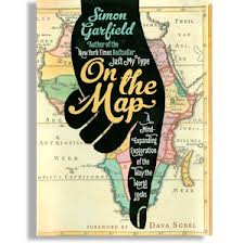
More recently I finished reading On the Map by Simon Garfield. I highly recommend it for he wittingly demonstrates through maps how history was and continues to be shaped by politics, greed, self expression and technology. Hopefully in paperback soon.


So, I'm off to find a haircut in Richmond. My first here. Does anyone have a map?


Tuesday, March 12, 2013

March Bluster

Yesterday was proclaimed to be a sunny warm day along the middle Chesapeake. I got up early to head  out for Gwynn's and noticed that 'sunny' had changed to overcast. But what the heck... it would still be warm. At least that's what was predicted. I found marina closed on Monday and Tuesday so I was quite alone and that was alright. There was much to sort out.

Once loaded I hooked up and crossed over the island bridge to the public boat ramp. It was high tide but a stiff cold wind was blowing onshore. So I stood there for a minute (alone) and scratched my head. Decided to lengthen the dock lines and drape them on land from the starboard side where I had decided to launch close to the bulkhead. Got wet, hustled and puppeted Annie out to the end with the wind pushing hard against us. Tied off with a couple of quick clove hitches. So far so good.

The outboard, fresh with its new juices, fired off easy. Soon we were in a short chop heading in the direction of Hole in the Wall. We passed a deadrise crew hoisting their oyster dredge. That type of fishing is limited but I suppose they were harvesting their quota whatever that might be. 


It was cold and the wind was following the creek right on our nose. I anchored, closed the spray hood and ate lunch in the lee. I sailed for a bit and made way back to the launch. The reload was "just as much fun" as the launch. Good practice. You get a lot single-handing.

Fast forward. I had rinsed off, flushed the outboard and started back to slot where I store Annie on trailer. The tires started spinning and before long we were mired up. I couldn't unhook the trailer, too low now and with 200 lb. tongue weight I was again scratching my head. Thanks to a pile of gathered pine needles in the ruts the wheels grabbed and I escaped. 

Annie performed well and is as beautiful as ever. Can I say as much for myself?


Sunday, March 10, 2013

Looking Down

Here is a photo sent to me by a friend of a friend taken from a kite cam at the start of the Everglades Challenge. More shots here.


Monday, March 4, 2013

Spring Track

In May I plan to explore the central Chesapeake Bay. Possibly the first or latter due to college graduation occurring on the 13th in Richmond. My preliminary track touches several places that interest me. Starting at Gwynn Island the course could start north in a clockwise circuit or east, counterclockwise. Will probably watch the weather and decide later.

I worked at Smith Island in the early '90s and look forward to returning. From the isolated culture, to feral cats, to the marsh "graveyard" for spent cars... it is a step back in time. My friend Steve of Log of Spartina may be in the area completing his circumnavigation of the Delmarva Peninsula. It would be great to be around when he and his friend Bruce finish.

Will start tomorrow researching safe harbors along the track...